
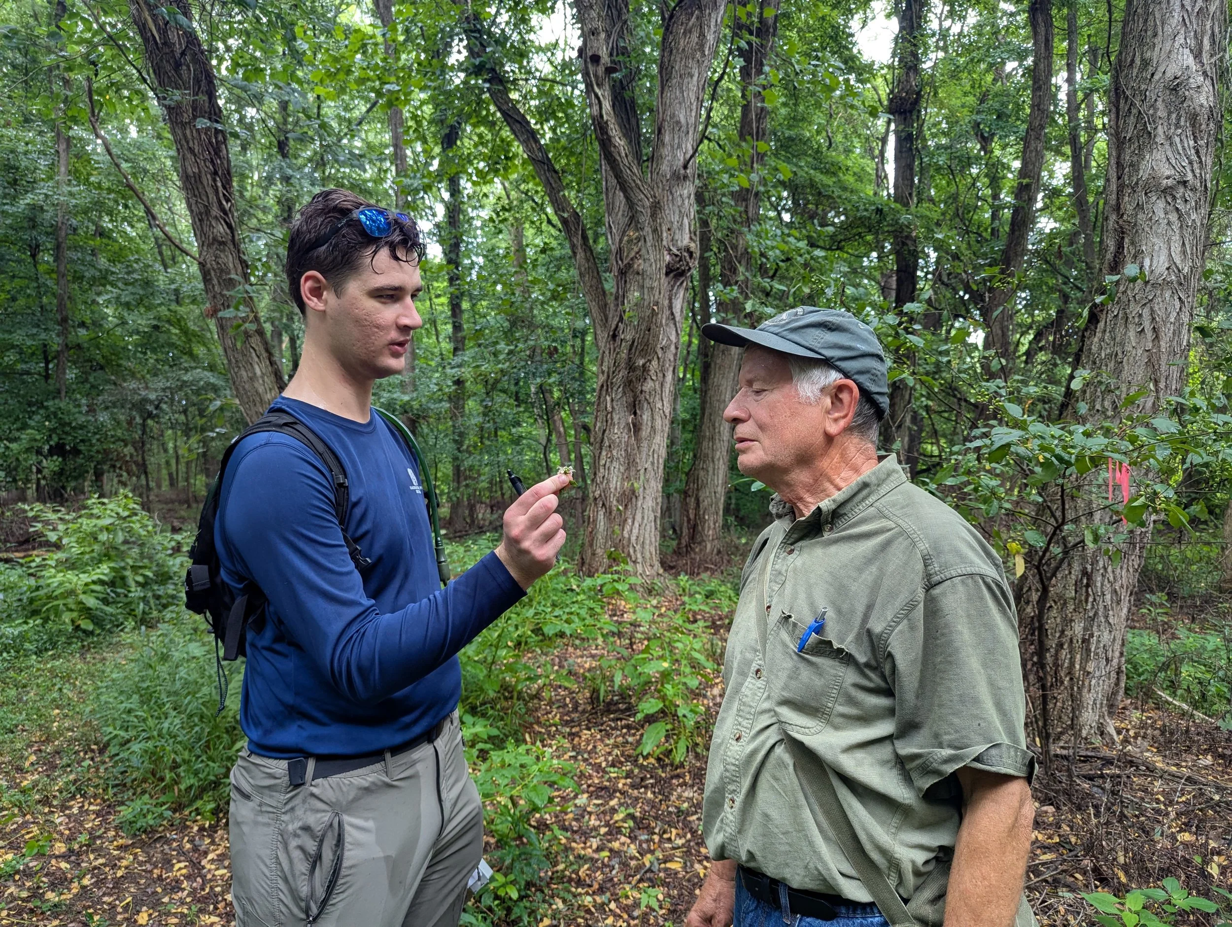
Rich Hull with OLC board member Jim Nardi
A Journey Into the Wabash River Corridor
When most people look at the woods and prairies along the Wabash River, they see a landscape shaped by water, time, and history. For Rich Hull, a doctoral student at Indiana University, those same landscapes are a living archive — a place where the shifting distribution of plants tells the story of climate change, invasive species, and the resilience of Indiana’s ecosystems.
Hull began his research nearly five years ago, eventually reaching out to the Ouabache Land Conservancy (OLC) for access to its preserves. His additional work at Atherton Island Natural Area (AINA) has been especially valuable, giving OLC a clearer picture of the land it is protecting. With the data Hull has gathered, OLC will be able to track plant species at the site over time and better understand changes in biodiversity. Both Atherton Island and the Jackson-Schnyder Nature Preserve are now part of Hull’s larger survey, which spans the Wabash River corridor from Tippecanoe County in the north to Posey County in the south.
Although connected in spirit, Hull’s project at Atherton Island is separate from his dissertation research. At AINA, his goal was to create a tool for OLC, a baseline list of plant species that can be revisited in the future to monitor shifts in biodiversity. This list was generated primarily through visual observations. By contrast, the sites included in his dissertation involved a more rigorous method: Hull collected and preserved physical specimens of every species he recorded. In total, he gathered more than 13,000 plant specimens, creating a permanent record of each species’ exact location. This collection not only ensures that identifications can be verified or corrected later, but also allows for adjustments as taxonomic concepts evolve, for example, when species are split into separate classifications or lumped together.
A Researcher’s Calling
Hull’s journey into botany began early. “By the time I was in 10th grade, I knew I wanted to work outside. I thought I’d become a wildlife biologist, but as I started documenting plants, I realized just how much was missing from the record,” Hull stated. In high school, he cataloged species in his home county in Georgia, a project that grew in college into formal research on fireflies and vascular plants. “That really hooked me. Plants are the foundation of everything else, from insects to birds to mammals. If we don’t understand what’s happening to plants, we don’t understand what’s happening to ecosystems,” Hull explained.
The Wabash River: A Corridor of Diversity
Hull chose the Wabash River Corridor for its unique ecological importance. Though only 10 counties are included in his study, they contain nearly 70 percent of Indiana’s native plants ever recorded in natural environments. “The Wabash packs an incredible amount of plant diversity into a relatively narrow stretch of land. It’s one of the best places to study how species adapt to climate change, because the corridor provides a natural pathway for northward migration,” Hull explained.
Two major biomes, the Eastern deciduous forest and the tallgrass prairie, have historically converged along the river, creating transition zones like oak savannas and barrens. The corridor also carries with it wide swings in climate: southern plants follow the Mississippi and Ohio rivers northward into Indiana, while northern species drift down from the Great Lakes.
What the Data Reveals
At the heart of Hull’s project is a comparison between modern field surveys and historic records, particularly those collected a century ago by botanist Charles Deam. Deam’s approach was to collect one specimen per species per county. That gave us a broad map of where plants existed, but it wasn’t site-specific like modern surveys. Reconciling county-level records with precise site surveys is a challenge, but it lets us see broader shifts in species presence and distribution,” Hull explained.
The results so far are striking. Invasive species are common in landscapes where they were once absent. Some native plants, considered “weedy” but resilient, are moving north faster than expected. A handful of rare species may be shifting out of their historical ranges altogether.
“Seeing plants move north within just 100 years is remarkable. Normally, that would take much longer without human-driven climate change,” Hull stated.
Why Seasonal Surveys Matter
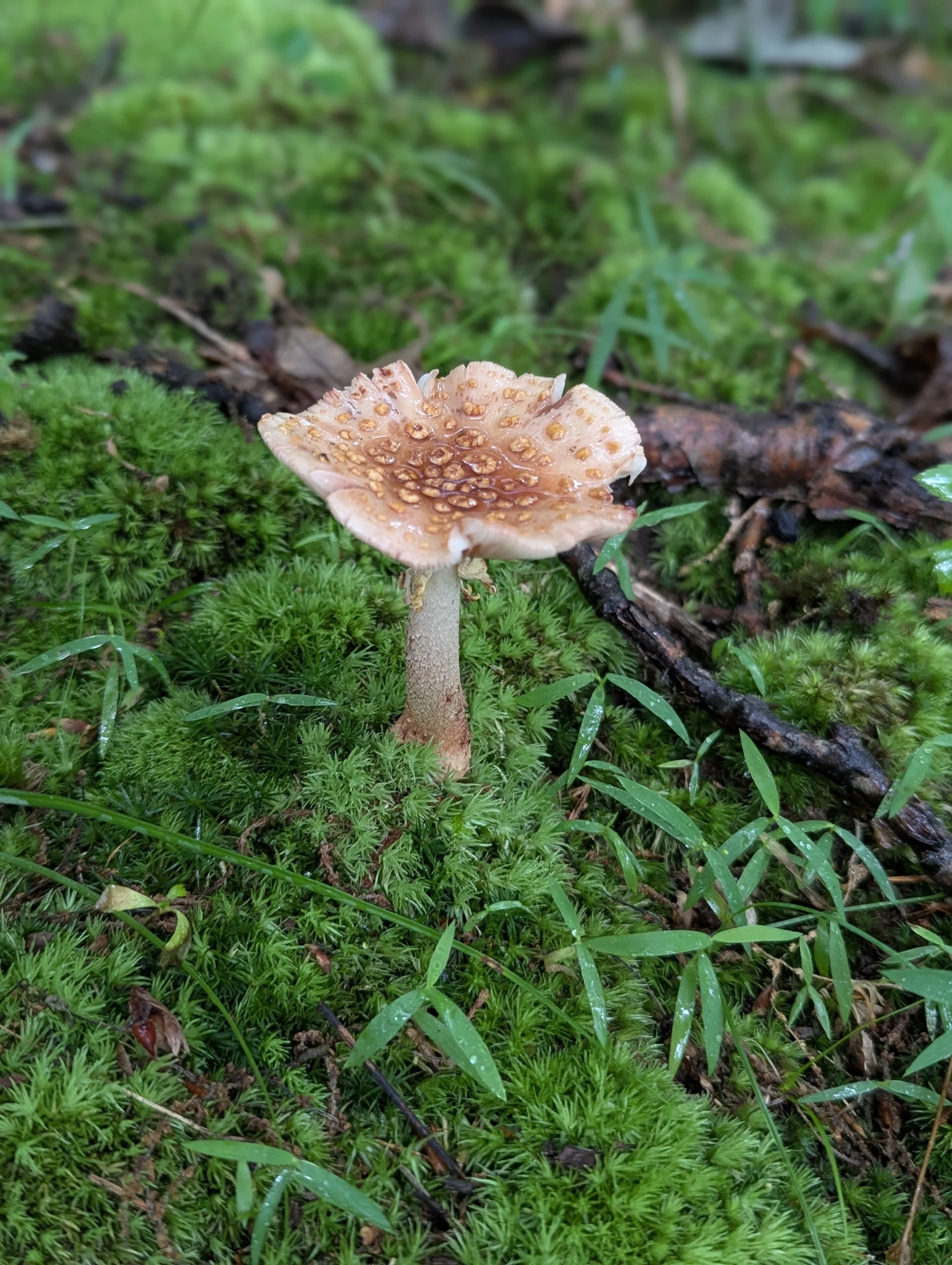
Documenting Atherton Island requires more than one visit a year. “If you miss a few weeks, you miss a whole group of plants. Spring ephemerals bloom and disappear quickly, sedges fruit for only two to four weeks, and oaks can only be properly identified when they’re dropping acorns in the fall,” Hull explained.
By visiting multiple times throughout the growing season, Hull can capture a more complete picture of the preserve’s biodiversity. In summer, sedges distinguish themselves. In the fall, asters, Indiana’s most prominent plant family, and oaks dominate the landscape. “Each trip fills another piece of the ecological puzzle,” Hull said.
Why It Matters to Everyone

For those who live far from nature, the loss of a plant species may feel distant. Hull argues otherwise. Plants are the foundation of terrestrial life. They provide food, shelter, and habitat for everything from insects to birds. They drive pollination, which underpins our crops. If we start losing native plants, we lose the building blocks of the ecosystems that sustain us,” Hull explained. Hull adds that there is also a heritage element at stake. “These species are part of our natural history. Preserving them means preserving something that defines Indiana and the Wabash Valley,” Hull exclaimed.
Lessons for Future Botanists
While passion for plants is essential, Hull emphasizes that modern botany requires broader skills. “Writing, statistics, coding, those are just as important. You can love plants, but if you can’t analyze the data or communicate it, the work doesn’t reach the people who need it,” Hull explained. Although the number of professional botanists has declined compared to past generations, Hull believes that this opens new opportunities. “There aren’t as many botanists as there used to be, but the need is just as strong. That makes the work rewarding and urgent,” Hull explained.
Looking Ahead
Hull’s dissertation will ultimately consist of at least three published chapters: a section of one is partially published in the Proceedings of the Indiana Academy of Science, updating county plant records; another comparing surveys at Fall Creek Gorge across decades, and a final synthesis analyzing distribution shifts across the corridor in relation to climate change.
For now, the work continues at places like Atherton Island. Each survey builds not only today’s dataset, but also the foundation for future scientists a century from now. The next scientist will have an easier time. They’ll be able to compare site surveys directly to what Hull recorded, and that will tell them how much further things have shifted with site-by-site context. In that sense, Atherton Island is not just a preserve; it’s a living time capsule.